Dreaming about a little land, a garden, and room for animals near Columbia? Buying a small farm or homestead in Maury County is exciting, but it is not the same as buying a house in town. You are buying land, infrastructure, and a set of permissions that shape what you can do. In this guide, you will get a clear plan for zoning, wells and septic, soils and flood maps, taxes, and the practical steps to buy with confidence. Let’s dive in.
Columbia small‑farm basics
Interest in acreage has grown as farmland values have climbed nationwide, including in Tennessee. The USDA’s Land Values report shows continued increases in recent years, with strong movement in parts of the Appalachian region. Reviewing the USDA NASS Land Values report can help you benchmark statewide trends while you evaluate a specific parcel.
At the local level, property value depends on the exact parcel: location and road frontage, utilities, topography, soils, and any easements or deed restrictions. That is why local due diligence matters more than statewide averages. A smart approach pairs public resources with a team that knows Maury County’s process.
For production questions, pasture potential, and practical planning, the University of Tennessee Extension’s Maury County office is a trusted resource for research‑based, local guidance. Keep their site handy as you explore options through UT Extension in Maury County.
Zoning: know what you can do
Maury County’s zoning framework accommodates agricultural and forestry uses in agricultural districts such as A‑1 and A‑2. The county has adopted a comprehensive zoning ordinance, with a new ordinance effective January 1, 2026. Before you write an offer, confirm the parcel’s current zoning district, permitted uses, and any special‑exception requirements in the Maury County Zoning Ordinance.
- Verify whether the property is inside the City of Columbia or in unincorporated Maury County, since rules can differ.
- Ask for the official zoning map layer and the text for your parcel’s district.
- If you plan agritourism, new outbuildings, or short‑term rentals, confirm what is allowed and what permits are required.
Water and utilities
In and around Columbia, you will typically see one of two water setups:
- Public water: Some parcels are served by municipal water through Columbia Power & Water Systems. Confirm the service area, whether there is an active meter, and any capacity or hookup fees with Columbia Power & Water Systems (CPWS).
- Private wells: In rural areas, properties often rely on private wells. Tennessee requires licensed well drillers and installers. The state maintains licensing, construction standards, and a searchable well‑report database. If a property has a well, request the driller’s report and any water‑quality testing records. If you will need a new well, speak with a licensed driller early. Learn more from TDEC’s well driller licensing and guidance.
Electricity and broadband availability vary by location. Ask sellers for recent utility bills and contact information for their providers so you can verify service and costs during contingencies.
Septic and environmental health
Many small farms in Maury County use onsite sewage systems. The Tennessee Department of Health’s Maury County office handles septic permits, soil and site review, and keeps records of past permits. Older or uncertified systems may need repair or replacement before you build or expand. Start your file with the Tennessee Department of Health South Central Region directory to locate the Maury County environmental health office.
- Request the septic permit, any as‑built drawings, and maintenance records.
- If no records exist, plan for a soils evaluation, percolation testing, and cost estimates for any required work.
- Expect that new systems may require a reserve area.
Soils, topography, and flood risk
Middle Tennessee soils and topography can change quickly across short distances. Soil type drives septic feasibility, pasture productivity, and where and how you can build. Start with a desktop review in the NRCS Web Soil Survey to see soil types and interpretive layers. For permitting certainty, hire a licensed soil scientist for a high‑intensity soil map and any needed percolation tests.
Water features are common. You may see ponds, springs, or creeks across a parcel. Always check FEMA flood maps. Properties in a Special Flood Hazard Area can face added permitting steps for any new or replacement structures, and lenders typically require flood insurance if a federally backed mortgage is involved. Review the FEMA Map Service Center resources through the FEMA Flood Map Service Center and ask for any existing elevation certificates.
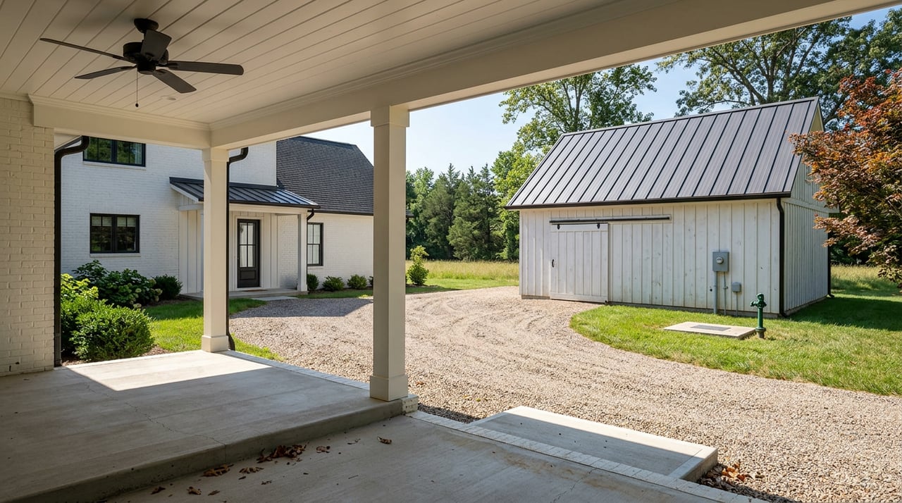
Farm features that add value
Listings for small farms and homesteads often include:
- Barns, sheds, and equipment storage
- Fenced pastures, cross‑fencing, and livestock handling pens
- Field fencing such as barbed‑wire or post‑and‑rail
- Paddocks for small crops or rotational grazing
- Lanes and driveways for access and animal movement
- Timber stands and ponds
For active livestock, well‑drained paddocks, safe water access, and functional working pens often matter more than the total acreage number. When in doubt, ask UT Extension for pasture and forage insights for your specific goals through UT Extension in Maury County.
Your step‑by‑step due diligence
A. Before contract or in early contingencies
- Confirm zoning and location: Verify whether the parcel is in the city or county and review permitted uses and any special exceptions in the Maury County Zoning Ordinance.
- Check flood maps: Pull FEMA flood panels and ask for prior elevation certificates if structures sit near low areas. Start with the FEMA Flood Map Service Center.
- Gather water and septic records: Request the well driller’s report and water‑quality results, plus the septic permit and as‑built map. Use the Tennessee Department of Health South Central Region directory to locate Maury County’s environmental health office.
- Run a soils screen: Review the parcel in the NRCS Web Soil Survey. For certainty, hire a licensed soil scientist for high‑intensity mapping and perc testing.
- Title review: Have the title company pull recorded easements, rights‑of‑way, covenants, and any conservation or agricultural easements. Confirm legal access from a public road or a properly deeded private easement with a maintenance agreement.
- Boundary survey: Order a current boundary or ALTA survey if fence lines or corners are unclear. If you intend to subdivide, review subdivision and access rules with the Maury County Building & Zoning Office.
B. Technical inspections and permits
- Septic feasibility: If repair or replacement is likely, get a soils specialist and licensed septic contractor to price options. The county environmental health office will specify acceptable documentation.
- Well evaluation or drilling: If no well exists, consult a TDEC‑licensed driller about likely depth, yield, and site constraints. If a well is present, verify its location, condition, and reporting status with TDEC’s well driller licensing and guidance.
- Structures and codes: Confirm permits for barns and outbuildings or whether they are grandfathered. If the site is flood‑prone or steep, you may need additional engineering and permits through Maury County Building & Zoning.
C. Finance, taxes, and insurance
- Present‑use valuation: Tennessee offers a present‑use valuation program for eligible agricultural, forest, and open‑space lands. Always confirm current classification and requirements with the Maury County Assessor, and do not rely on seller statements. For statute context, see Title 67 Taxes and Licenses.
- Lender requirements: If the property is in a mapped flood zone, lenders typically require flood insurance. Many lenders also require proof that private wells and septic systems function properly before closing.
D. Common deal‑breakers to watch
- No legal access, unclear easements, or unrecorded private drive agreements
- Failed or unpermitted septic with no repairable area
- Poor soils for septic or building or very shallow rock
- Significant mapped floodplain that limits building or expansion
- Utility distances or capacity limits that make hookups cost‑prohibitive
- Lack of a dependable well or confirmed municipal water capacity
Quick buyer checklist
- Confirm parcel zoning and permitted uses for your exact lot in the Maury County Zoning Ordinance.
- Check the FEMA flood map for the address and ask for any elevation certificates via the FEMA Flood Map Service Center.
- Request the well driller’s report and recent water‑quality results, septic permit and as‑built, and recent utility bills.
- Screen soils in the NRCS Web Soil Survey and hire a licensed soil scientist if you need septic certainty.
- Confirm legal access and recorded easements through a title search and recorded documents.
- If you plan buildings or changes, get a preliminary review from Maury County Building & Zoning.
- Ask the Maury County Assessor about present‑use valuation and how to maintain it, referencing Title 67.
- Get written estimates from licensed well drillers, septic contractors, fencing installers, and utility providers before waiving contingencies.
Who to call in Maury County
- Maury County Building & Zoning Office for permits, zoning maps, and subdivision rules
- Tennessee Department of Health South Central Region to reach the Maury County environmental health office for septic records and permitting
- TDEC well driller licensing and well reports for licensed drillers and state well information
- UT Extension in Maury County for local agronomy, pasture, and small‑farm guidance
- FEMA Flood Map Service Center for official flood mapping resources
- Columbia Power & Water Systems (CPWS) for municipal electric and water service areas
How The Phillips Group helps you buy acreage
Buying acreage is often about managing constraints and verifying permissions. You want a team that can move fast on zoning, soils, wells, septic, surveys, title, and flood maps, then pull in the right specialists at the right time. Our concierge approach coordinates due diligence, connects you with trusted local pros, and keeps your contract protections tight so you can focus on your vision for the land.
Whether you are picturing a small livestock setup, a market garden, or a low‑maintenance homestead close to Columbia, we are ready to help you source options, structure offers, and close smoothly. If you are considering a sale, we also advise on which improvements and documentation will protect value with acreage buyers.
Ready to walk a property or map out a search strategy? Connect with The Phillips Group to get started.
FAQs
How do I confirm zoning for a rural parcel in Maury County?
- Review the parcel’s district, allowed uses, and any special exceptions in the Maury County Zoning Ordinance and verify whether the land is inside city limits or unincorporated county.
Who handles septic permits and records in Maury County?
- The Tennessee Department of Health’s Maury County environmental health office manages septic permitting, site review, and records; start with the South Central Region directory to contact the local office.
How can I check flood risk for acreage in Columbia, TN?
- Use the FEMA Flood Map Service Center to view flood panels for the address and request any existing elevation certificates for buildings on the property.
What is present‑use valuation for Tennessee farmland taxes?
- Tennessee allows qualifying agricultural, forest, and open‑space lands to be taxed based on present use; confirm current classification and requirements with the Maury County Assessor and see Title 67 for statute context.
What well documentation should I request when buying in Tennessee?
- Ask for the well driller’s report and any water‑quality results, and verify the well’s status and driller licensing through TDEC’s guidance.
What farm features matter most for a small livestock setup?
- Functional infrastructure like well‑drained paddocks, safe water access, and working pens typically matters more than total acreage; UT Extension can help assess pasture potential via UT Extension in Maury County.